Day 0
 |
| Drift map of Malham Tarn area |
Day 1
 |
| Oh grikey! |
 |
| Watlows dry valley |


 |
| Water sink with river of OU students |
Around here we see the last outcrop of in situ limestone. The tarn sits on top of the impermeable Horton Formation (Silurian laminated hemipelagic silty mudstones) which as we can see from the geology map lies between 2 faults making it a horst.
 |
| Phase 1 habitat survey |
Day 2


2. Cave fed stream
3. Confluence of 1 and 2
4. Lower dipwell
5. Upper dipwell
6. Tarn
8. Goredale beck
Temperature: The cave fed streams are cool (10 C) but warm slightly by confluence (12C). The tarn water is high (18.5 C) as it sits in a shallow lake absorbing heat. The peat bog absorbs heat so relatively warm (15 C lower, 17 C upper). Goredale beck is cave fed but has been heated (15 C)
Conductivity: Measuring Ca2+ at these locations. High in cave water (470 - 560 uS), low in bog (54-83 uS). Caves have picked up Ca2+ from limestone, bog is rain fed. Low at tarn outflow (89 uS) as calcium precipitates out as marl mud as plants use CO2.
pH: Cave fed between 7.3 and 8.3, bog 4 - 5 (pH of rainwater is 5). The tarn is alkaline (pH 8.5-9) - removal of CO2 from water removes carbonic acid so pH goes up.
We also did lots of flow stuff but quite frankly it doesn't interest me so I won't write it up.
Day 3
 |
| Rendzina, probably wouldn't go with a kebab |
The soil at the top is a renzdzina, with an O horizon overlaying the limestone regolith.
At pit 2 we saw a poorly developed brown earth.
At pit 3 this has evolved into a podsol with a thick O horizon, an ashen A horizon and a permeable iron pan above the reddy coloured B horizon.
At pit 4 was a peaty gleyed podsol/stagno-gley podsol with a true (>20cm thick) peat horizon, a thick glayed A horizon, and impermeable iron pan and loess/limestone regolith at the bottom.
 |
| Robin and Hilary demonstrate synchronized augering |
Day 4
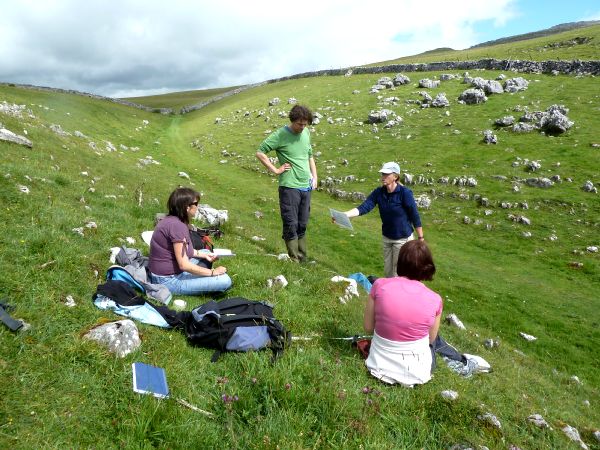 |
| Estimating DOMIN values |
In the evening we had a "pub quiz" (exam) on what we had learned so far. Then the celebrating began.
Days 5 and 6
 |
| Ha Mire |
Now we had the skills we had to apply them in the field. Not easy after the celebrations of the night before. Each group was given a site and taken for initial observations at 2 bamboo canes. We then had to use these to formulate a hypothesis and plan the experiments to test it. Our site was at Ha Mire and we decided to do an NVC, soil tests (pH and moisture) and later we tested water conductivity around the site. One team member and myself got the job of doing the NVC. Never have I hated plants, and especially grass, so much. The first day we did the upper site, but we missed the point and surveyed an area without the key species of thyme! The second day we did the mire which was much easier. After much manipulation and help we came up with classifications of GC10 for the upper site and M10 for the lower. The other team members did the other tests. I think we did alright in the end, despite only having 2 days plant spotting to help us!
At the end of day 5 we had a toast to commiserate the demise of SXR216. Although non of us would have gone again it is a shame that no other students will be able to share the experience. We got a copy of a DVD once used in the course - they won't be needing it any more. All in all it was an intense and brilliant week, with lots of interest on the course and the gossip it generated to keep us all amused throughout the week. Farewell SXR216, missing you already.


